Search
You Searched For
Search Results
- Published / Created:
- circa 1995-2017
- Call Number:
- VRC 1990a
- Image Count:
- 10
- Found in:
- Robert B. Haas Family Arts Library Special Collections > Garvin City Planning Image Collection (VRC 1990a) > U.S. Cities > > NEBRASKA > Omaha > Aerial > River
- Published / Created:
- circa 1995-2017
- Call Number:
- VRC 1990a
- Image Count:
- 2
- Found in:
- Robert B. Haas Family Arts Library Special Collections > Garvin City Planning Image Collection (VRC 1990a) > U.S. Cities > NEBRASKA > Omaha > Missouri River
- Published / Created:
- circa 1995-2017
- Call Number:
- VRC 1990a
- Image Count:
- 13
- Found in:
- Robert B. Haas Family Arts Library Special Collections > Garvin City Planning Image Collection (VRC 1990a) > U.S. Cities > > NEBRASKA > Omaha > North Omaha > North Expressway
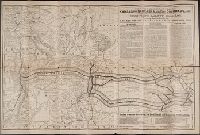
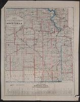
- Creator:
- Rand McNally and Company
- Call Number:
- Zc20 880un
- Collection Title:
- The Union Pacific Ry. through Kansas or Nebraska to the Colorado. Mines and resorts
- Image Count:
- 1
- Subject (Geographic):
- Missouri River Valley --Description and
- Subject (Topic):
- Railroads --Missouri River Valley
- Found in:
- Beinecke Rare Book and Manuscript Library > Revised map of the Union Pacific Railway, its branches and connecting stage lines
- Published / Created:
- 187-?]
- Call Number:
- 825gme 1870
- Container / Volume:
- BRBL_00576
- Image Count:
- 1
- Resource Type:
- Maps, Atlases & Globes
- Subject (Name):
- Missouri River, Fort Scott & Gulf
- Found in:
- Beinecke Rare Book and Manuscript Library > Map of eastern Kansas : showing the lines of the Mo.R.F.S. & G.R.R. and connections.
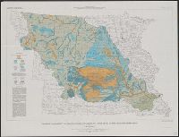
- Creator:
- La Rocque, George A., 1908-
- Published / Created:
- 1966
- Call Number:
- 817cbj 1966
- Container / Volume:
- BRBL_00564
- Image Count:
- 1
- Resource Type:
- Maps, Atlases & Globes
- Alternative Title:
- Missouri River Basin
- Subject (Geographic):
- Missouri River Watershed--Maps
- Subject (Topic):
- Groundwater--Missouri River Watershed
- Found in:
- Beinecke Rare Book and Manuscript Library > General availability of ground water and depth to water level in the Missouri River Basin / by G.A. La Rocque, Jr.
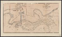
- Creator:
- Union Pacific Railroad Company
- Published / Created:
- 1867?]
- Call Number:
- 824 Om1 1867
- Container / Volume:
- BRBL_00571
- Image Count:
- 1
- Resource Type:
- Maps, Atlases & Globes
- Subject (Topic):
- Railroad bridges--Missouri River--Maps
- Found in:
- Beinecke Rare Book and Manuscript Library > Map to accompany report of J.L. Williams on the bridging of the Missouri River / Union Pacific Rail Road.
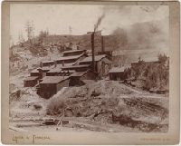
- Creator:
- Locke, H. R
- Published / Created:
- 1895-1892
- Call Number:
- WA Photos 127
- Collection Title:
- Photographs of South Dakota and Wyoming
- Image Count:
- 2
- Subject (Name):
- Burlington and Missouri River Railroad
- Found in:
- Beinecke Rare Book and Manuscript Library > Deadwood & Delaware Smelting Works, on the B. & M. R. R. Deadwood, S.D
- Creator:
- Locke, H. R
- Published / Created:
- 1895-1892
- Call Number:
- WA Photos 127
- Collection Title:
- Photographs of South Dakota and Wyoming
- Image Count:
- 2
- Subject (Name):
- Burlington and Missouri River Railroad
- Found in:
- Beinecke Rare Book and Manuscript Library > Deadwood. S. Dak. on the B. & M. R. R
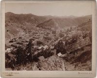
- Creator:
- Locke, H. R
- Published / Created:
- 1895-1892
- Call Number:
- WA Photos 127
- Collection Title:
- Photographs of South Dakota and Wyoming
- Image Count:
- 2
- Subject (Name):
- Burlington and Missouri River Railroad
- Found in:
- Beinecke Rare Book and Manuscript Library > Devil's Tower, 800 feet high from base, 1,200 feet high above Belle Fourche River, along the B. & M. R.R., Wyoming