Search
You Searched For
Search Results
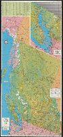
- Creator:
- Brenner, G. E
- Published / Created:
- 1971
- Call Number:
- 739 1971
- Container / Volume:
- BRBL_00389
- Image Count:
- 2
- Resource Type:
- Maps, Atlases & Globes
- Subject (Geographic):
- British Columbia--Maps
- Subject (Topic):
- Roads--British Columbia--Maps
- Found in:
- Beinecke Rare Book and Manuscript Library > Beautiful British Columbia [cartographic material] : 1971-1972 road map, campground & fishing guide / G.E. Brenner, cartographer.
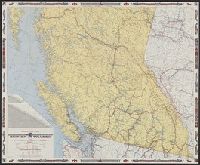
- Creator:
- British Columbia Government Travel Bureau
- Published / Created:
- 1954
- Call Number:
- 739 1954
- Container / Volume:
- BRBL_00389
- Image Count:
- 2
- Resource Type:
- Maps, Atlases & Globes
- Subject (Geographic):
- British Columbia--Maps
- Subject (Topic):
- Roads--British Columbia--Maps
- Found in:
- Beinecke Rare Book and Manuscript Library > Highway and travel map of British Columbia / Basic map data by Geological Survey of Canada ; tourist information by Geographic Division, Surveys and Mapping Branch, Department of Lands and Forests.
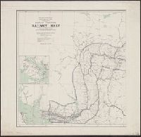
- Creator:
- Canada. Dept. of the Interior
- Published / Created:
- 1908
- Call Number:
- 739 1908
- Container / Volume:
- BRBL_00388
- Image Count:
- 2
- Resource Type:
- Maps, Atlases & Globes
- Subject (Geographic):
- British Columbia--Maps
- Subject (Topic):
- Railroads--British Columbia--Maps
- Found in:
- Beinecke Rare Book and Manuscript Library > British Columbia railway belt / Dept. of the Interior ; prepared under the direction of R.E. Young, Superintendent of Railway and Swamp Lands ; James White, F.R.G.S., geographer.
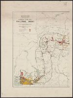
- Creator:
- Canada. Dept. of the Interior
- Published / Created:
- 1907
- Call Number:
- 739G 1907
- Container / Volume:
- BRBL_00392
- Image Count:
- 2
- Resource Type:
- Maps, Atlases & Globes
- Subject (Geographic):
- British Columbia--Maps
- Subject (Topic):
- Railroads--British Columbia--Maps
- Found in:
- Beinecke Rare Book and Manuscript Library > British Columbia railway belt / Dept. of the Interior; prepared under the direction of R.E. Young, Superintendent of Railway and Swamp Lands; James White, F.R.G.S., geographer.
- Creator:
- Fisher, Steven
- Published / Created:
- c1986.
- Call Number:
- 739 1986
- Container / Volume:
- BRBL_00389
- Image Count:
- 1
- Resource Type:
- Maps, Atlases & Globes
- Subject (Geographic):
- British Columbia--Maps
- Subject (Topic):
- Coasts--British Columbia--Maps
- Found in:
- Beinecke Rare Book and Manuscript Library > British Columbia's coast, the Canadian inside passage / cartographics by Steven Fisher.
- Creator:
- British Columbia. Dept. of Lands
- Published / Created:
- 1911
- Call Number:
- 739 1911B
- Container / Volume:
- BRBL_00388
- Image Count:
- 1
- Resource Type:
- Maps, Atlases & Globes
- Subject (Geographic):
- British Columbia--Maps
- Subject (Topic):
- Railroads--British Columbia--Maps
- Found in:
- Beinecke Rare Book and Manuscript Library > Map of the Province of British Columbia.
- Creator:
- H.M. Gousha Company
- Published / Created:
- 1939
- Call Number:
- 739gmb 1939
- Container / Volume:
- BRBL_00393
- Image Count:
- 2
- Resource Type:
- Maps, Atlases & Globes
- Alternative Title:
- Shell road map, British Columbia
- Subject (Geographic):
- British Columbia--Maps
- Subject (Topic):
- Roads--British Columbia--Maps
- Found in:
- Beinecke Rare Book and Manuscript Library > Official road map of British Columbia.
- Creator:
- Canada. Topographical Survey
- Published / Created:
- [1909]
- Call Number:
- 739CBF B386 1909
- Container / Volume:
- BRBL_00391
- Image Count:
- 1
- Resource Type:
- Maps, Atlases & Globes
- Subject (Geographic):
- British Columbia--Maps
- Subject (Topic):
- Triangulation--British Columbia--Maps
- Found in:
- Beinecke Rare Book and Manuscript Library > Sketch map of part of the railway belt, British Columbia : showing main topographical features in the districts drained by the Blaeberry River, Bush River, Gold Creek and their confluents. Also the Continental Divide northwest from Mt. Freshfield.
- Creator:
- Epner, Gustavus
- Published / Created:
- 1862
- Call Number:
- 739 F86 1862
- Container / Volume:
- BRBL_00389
- Image Count:
- 1
- Resource Type:
- Maps, Atlases & Globes
- Subject (Topic):
- Distances--British Columbia--Maps
- Found in:
- Beinecke Rare Book and Manuscript Library > Map of the gold regions in British Columbia / [cartographic material] compiled from sketches and information by His Excellency James Douglas, C.B., Governor of British Columbia and Vancouver Island and from data obtained from the most intelligent and reli
- Creator:
- British Columbia. Dept. of Lands and Forests
- Published / Created:
- 1943
- Call Number:
- 739 B41 1943
- Container / Volume:
- BRBL_00389
- Image Count:
- 1
- Resource Type:
- Maps, Atlases & Globes
- Subject (Topic):
- Coasts--British Columbia--Maps
- Found in:
- Beinecke Rare Book and Manuscript Library > Bella Coola, 1924.