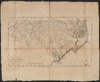
Search
You Searched For
Search Results
- Published / Created:
- 1770
- Call Number:
- 785 1770
- Container / Volume:
- BRBL_00513
- Image Count:
- 1
- Resource Type:
- Maps, Atlases & Globes
- Subject (Geographic):
- North Carolina--Maps--Early works to
- Found in:
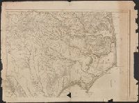
- Beinecke Rare Book and Manuscript Library > A Compleat Map of North-Carolina from an actual Survey. By Capnt. [John A. ] Collet, Governor of Fort Johnson, Engraved by I. Bayly. Published according to Act of Parliament May the 1st. 1770, by S. Hooper Nọ 25 Ludgate Hill, London.
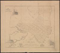
- Published / Created:
- [1800?]
- Call Number:
- 785 N423 1800
- Container / Volume:
- BRBL_00513
- Image Count:
- 1
- Resource Type:
- Maps, Atlases & Globes
- Subject (Geographic):
- North Carolina--Maps--Early works to
- Found in:
- Beinecke Rare Book and Manuscript Library > A Plan of the Town of New Bern and Dryborough ... By Jonathan Price.
- Published / Created:
- 1796]
- Call Number:
- 785 1796A
- Container / Volume:
- BRBL_00513
- Image Count:
- 1
- Resource Type:
- Maps, Atlases & Globes
- Subject (Geographic):
- North Carolina--Maps--Early works to
- Found in:
- Beinecke Rare Book and Manuscript Library > The State of North Carolina from the best authorities &c. by S. Lewis.
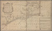
- Published / Created:
- [1738]
- Call Number:
- 785cea 1738
- Container / Volume:
- BRBL_00514
- Image Count:
- 1
- Resource Type:
- Maps, Atlases & Globes
- Subject (Geographic):
- North Carolina--Maps--Early works to
- Found in:
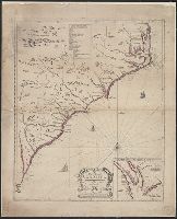
- Beinecke Rare Book and Manuscript Library > To his grace Thomas Hollis Pelham, Duke of Newcastle... : this chart of his majesties province of North Carolina... / James Wimble... 1738.
- Published / Created:
- [1749?]
- Call Number:
- 7855 1749
- Container / Volume:
- BRBL_00515
- Image Count:
- 1
- Resource Type:
- Maps, Atlases & Globes
- Subject (Geographic):
- North Carolina--Maps--Early works to
- Found in:
- Beinecke Rare Book and Manuscript Library > A New Mapp of Carolina By John Thornton at ye Platt in ye Minories And Will: Fisher at ye Postorn Gate on Towerhill, London.
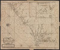
- Published / Created:
- 1684?]
- Call Number:
- 7855 1684
- Container / Volume:
- BRBL_00515
- Image Count:
- 2
- Resource Type:
- Maps, Atlases & Globes
- Subject (Geographic):
- North Carolina--Maps--Early works to
- Found in:
- Beinecke Rare Book and Manuscript Library > A new map of Carolina. By Philip Lea at the Atlas and hercules in Cheap Side.
- Published / Created:
- 1775
- Call Number:
- 7855 1775C
- Container / Volume:
- BRBL_00515
- Image Count:
- 1
- Resource Type:
- Maps, Atlases & Globes
- Subject (Geographic):
- North Carolina--Maps--Early works to
- Found in:
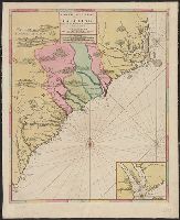
- Beinecke Rare Book and Manuscript Library > An Accurate Map of North and South Carolina With Their Indian Frontiers, Shewing ... from Actual Surveys by Henry Mouzon and Others.
- Creator:
- Sanson, Nicolas, 1600-1667
- Published / Created:
- [1700?]
- Call Number:
- 7855 1693
- Container / Volume:
- BRBL_00515
- Image Count:
- 1
- Resource Type:
- Maps, Atlases & Globes
- Subject (Geographic):
- North Carolina--Maps--Early works to
- Found in:
- Beinecke Rare Book and Manuscript Library > Carte general de la Caroline / dresse sur les Memoires le plus nouveaux par le Sieuna S --.
- Creator:
- Pocock, Nathaniel
- Published / Created:
- 1777
- Call Number:
- 7855 1777P
- Container / Volume:
- BRBL_00730
- Image Count:
- 1
- Resource Type:
- Maps, Atlases & Globes
- Subject (Geographic):
- North Carolina--Maps--Early works to
- Found in:
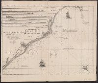
- Beinecke Rare Book and Manuscript Library > Nouvelle carte des côtes des Carolines Septentrionales et Meridionales du Cap Fear a Sud Edisto ... / par N. Pocock ...
- Creator:
- Moxon, J. (James)
- Call Number:
- EEg 671P
- Collection Title:
- America: being the latest, and most accurate description of the New world; containing the original
- Image Count:
- 1
- Subject (Geographic):
- North Carolina --Maps --Early works to
- Found in:
- Beinecke Rare Book and Manuscript Library > A new discription of Carolina by order of the Lords proprietors