Search
You Searched For
Search Results
- Published / Created:
- 178-?]
- Call Number:
- 71 1780C
- Container / Volume:
- BRBL_00366
- Image Count:
- 1
- Resource Type:
- Maps, Atlases & Globes
- Subject (Geographic):
- Canada--Maps--Early works to 1800
- Subject (Topic):
- Fur trade--Canada--Maps--Early works to
- Found in:
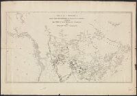
- Beinecke Rare Book and Manuscript Library > A map of America between latitudes 40 and 70 north, and longitudes 45 and 180 west : exhibiting the principal trading stations of the North West Company.
- Creator:
- Bowen, Emanuel, d. 1767
- Published / Created:
- 1752]
- Call Number:
- 73 1752A
- Container / Volume:
- BRBL_00373
- Image Count:
- 1
- Resource Type:
- Maps, Atlases & Globes
- Subject (Geographic):
- Canada--Maps--Early works to 1800
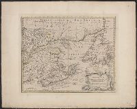
- Found in:
- Beinecke Rare Book and Manuscript Library > A new and accurate map of the islands of Newfoundland, Cape Breton, St. John and Anticosta : together with the neighbouring countries of Nova Scotia, Canada, &c. / drawn from the most approved modern maps and charts and regulated by Astronl. observatns. b
- Creator:
- Aa, Pieter van der, 1659-1733
- Published / Created:
- [1714]
- Call Number:
- 73 1714
- Container / Volume:
- BRBL_00688
- Image Count:
- 1
- Resource Type:
- Maps, Atlases & Globes
- Subject (Geographic):
- Canada--Maps--Early works to 1800
- Found in:
- Beinecke Rare Book and Manuscript Library > Canada, ou, Nouvelle France [cartographic material] : suivant les nouvelles observations de Mess'rs. de l'Academie Royale des Sciences, etc., augmentées de nouveau.
- Published / Created:
- [1703?]
- Call Number:
- 755 1703
- Container / Volume:
- BRBL_00424
- Image Count:
- 1
- Resource Type:
- Maps, Atlases & Globes
- Subject (Geographic):
- Canada--Maps--Early works to 1800
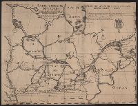
- Found in:
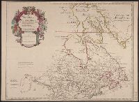
- Beinecke Rare Book and Manuscript Library > Carte Generale de Canada. Dediée au roy de Danemark par son trés humble et trés obeissant et trés fidele serviteur Lahontan.
- Published / Created:
- 1778
- Call Number:
- 755 1778B
- Container / Volume:
- BRBL_00432
- Image Count:
- 1
- Resource Type:
- Maps, Atlases & Globes
- Subject (Geographic):
- Canada--Maps--Early works to 1800
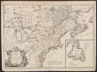
- Found in:
- Beinecke Rare Book and Manuscript Library > Carte du Canada et des Etats-Unis de l'Amerique Septentrionale par le Sr. Robert de Vangondy ...
- Creator:
- L'Isle, Guillaume de, 1675-1726
- Published / Created:
- 1703 [i.e. 1718]
- Call Number:
- 755 1703B
- Container / Volume:
- BRBL_00424
- Image Count:
- 1
- Resource Type:
- Maps, Atlases & Globes
- Subject (Geographic):
- Canada--Maps--Early works to 1800
- Found in:
- Beinecke Rare Book and Manuscript Library > Carte du Canada ou de la Nouvelle France et des decouvertes qui y ont été faites / dressée sur plusieurs observations et sur un grand nombre de relations imprimées ou manuscrites par Guillaume del'Isle de l'Academie royale des sciences et premier geog
- Creator:
- Wytfliet, Corneille
- Published / Created:
- 1597]
- Call Number:
- 73 1597A
- Container / Volume:
- BRBL_00727
- Image Count:
- 1
- Resource Type:
- Maps, Atlases & Globes
- Subject (Geographic):
- Canada--Maps--Early works to 1800
- Found in:
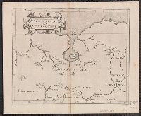
- Beinecke Rare Book and Manuscript Library > Conibas regio cum vicinis gentibus [cartographic material].
- Published / Created:
- 1778
- Call Number:
- 755 1778A
- Container / Volume:
- BRBL_00432
- Image Count:
- 1
- Resource Type:
- Maps, Atlases & Globes
- Subject (Geographic):
- Canada--Maps--Early works to 1800
- Found in:
- Beinecke Rare Book and Manuscript Library > Il Canadá, le colonie Inglesi con la Luigiana, Florida di nuova projezione.
- Published / Created:
- 1755
- Call Number:
- 755FD 1755
- Container / Volume:
- BRBL_00442
- Image Count:
- 1
- Resource Type:
- Maps, Atlases & Globes
- Subject (Geographic):
- Canada--Maps--Early works to 1800
- Found in:
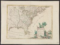
- Beinecke Rare Book and Manuscript Library > Nouvelle Ecosse ou partie orientale du Canada. Traduitte de l'Anglois de la carte de Jefferys ...