Search
You Searched For
Search Results
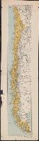
- Creator:
- Edward Stanford Ltd
- Published / Created:
- [1912?]
- Call Number:
- 96 1912
- Container / Volume:
- BRBL_00676
- Image Count:
- 1
- Resource Type:
- Maps, Atlases & Globes
- Subject (Geographic):
- Chile--Maps
- Found in:
- Beinecke Rare Book and Manuscript Library > Chile.
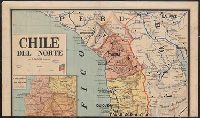
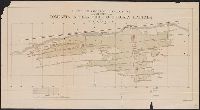
- Creator:
- Robelin, L
- Published / Created:
- 1891?]
- Call Number:
- 96 1891
- Container / Volume:
- BRBL_00676
- Image Count:
- 2
- Resource Type:
- Maps, Atlases & Globes
- Subject (Geographic):
- Chile--Maps
- Found in:
- Beinecke Rare Book and Manuscript Library > Chile del Norte / por L. Robelin.
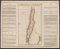
- Published / Created:
- [1830?]
- Call Number:
- 96 1830
- Container / Volume:
- BRBL_00676
- Image Count:
- 1
- Resource Type:
- Maps, Atlases & Globes
- Subject (Geographic):
- Chile--Maps
- Found in:
- Beinecke Rare Book and Manuscript Library > Chili.
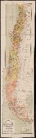
- Published / Created:
- 1904
- Call Number:
- 96 1904
- Container / Volume:
- BRBL_00676
- Image Count:
- 2
- Resource Type:
- Maps, Atlases & Globes
- Subject (Geographic):
- Chile--Maps
- Found in:
- Beinecke Rare Book and Manuscript Library > Nuevo mapa de Chile : formado con arreglo a los datos oficiales mas recientes i los ultimos levantamientos efectuados por las comisiones de limites . / por Nicanor Boloña.
- Published / Created:
- 1890
- Call Number:
- 96gfc 1890
- Container / Volume:
- BRBL_00676
- Image Count:
- 1
- Resource Type:
- Maps, Atlases & Globes
- Subject (Geographic):
- Chile--Maps
- Found in:
- Beinecke Rare Book and Manuscript Library > Plano en Seccion Horizontal de la Mina de la Compañia Inglesa Chile o yuruary limitada / por M.E. Palacio C.M.E.
- Creator:
- Maury, Matthew Fontaine, 1806-1873
- Published / Created:
- 1852
- Call Number:
- 11cfk 1850C-9
- Container / Volume:
- BRBL_00772
- Image Count:
- 2
- Resource Type:
- Maps, Atlases & Globes
- Subject (Geographic):
- Horn, Cape, Region (Chile)--Maps
- Found in:
- Beinecke Rare Book and Manuscript Library > Pilot chart for Cape Horn [cartographic material] / by M.F. Maury, L.L.D. Lieut. U.S. Navy, Superin'dt. of U.S.N. Observatory ; compiled from materials in the Bureau of Ordnance and Hydrography, Commodore Charles Morris, Chief of Bureau.
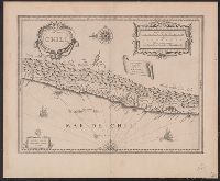
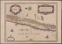
- Creator:
- Blaeu, Willem Janszoon, 1571-1638
- Published / Created:
- [ca. 1630]
- Call Number:
- 96 1667
- Container / Volume:
- BRBL_00676
- Image Count:
- 1
- Resource Type:
- Maps, Atlases & Globes
- Subject (Geographic):
- Chile--Maps--Early works to 1800
- Found in:
- Beinecke Rare Book and Manuscript Library > Chili [cartographic material].
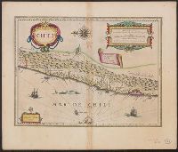
- Creator:
- Hondius, Jodocus, 1594 or 1595-1629
- Published / Created:
- [1629]
- Call Number:
- 96 1580
- Container / Volume:
- BRBL_00699
- Image Count:
- 1
- Resource Type:
- Maps, Atlases & Globes
- Subject (Geographic):
- Chile--Maps--Early works to 1800
- Found in:
- Beinecke Rare Book and Manuscript Library > Chili [cartographic material].
- Creator:
- Blaeu, Willem Janszoon, 1571-1638
- Published / Created:
- [ca. 1635]
- Call Number:
- 96 1667A
- Container / Volume:
- BRBL_00699
- Image Count:
- 2
- Resource Type:
- Maps, Atlases & Globes
- Subject (Geographic):
- Chile--Maps--Early works to 1800
- Found in:
- Beinecke Rare Book and Manuscript Library > Chili [cartographic material].