Search
You Searched For
Search Results
- Published / Created:
- 1762]
- Call Number:
- 855 1762A
- Container / Volume:
- BRBL_00695
- Image Count:
- 1
- Resource Type:
- Maps, Atlases & Globes
- Subject (Geographic):
- Cuba--Maps--Early works to 1800
- Found in:
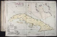
- Beinecke Rare Book and Manuscript Library > A new chart of the seas surrounding the island of Cuba with the soundings, currents, ships, courses &c. and a map of the island itself lately made by an officer in the Navy [cartographic material].
- Creator:
- Tardieu, P. F. (Pierre François), 1757-1822
- Published / Created:
- 1798]
- Call Number:
- 855 1798
- Container / Volume:
- BRBL_00641
- Image Count:
- 1
- Resource Type:
- Maps, Atlases & Globes
- Subject (Geographic):
- Cuba--Maps--Early works to 1800
- Found in:
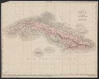
- Beinecke Rare Book and Manuscript Library > Carte de l'Isle de Cuba et des Isles Lucayes / Tardieu sculp,; André scrip.
- Creator:
- Bellin, Jacques Nicolas, 1703-1772, creator
Choiseul, Etienne-Francois, duc de, 1719-1785
France, Depot des cartes et plans de la marine
- Published / Created:
- 1762?
- Call Number:
- 2003 Folio 85
- Image Count:
- 1
- Subject (Geographic):
- Cuba -- Maps -- Early works to 1800
- Found in:
- Beinecke Rare Book and Manuscript Library > Carte reduite de l'isle de Cube
- Published / Created:
- [1850?]
- Call Number:
- 855cea 1850
- Container / Volume:
- BRBL_00642
- Image Count:
- 1
- Resource Type:
- Maps, Atlases & Globes
- Subject (Geographic):
- Cuba--Maps--Early works to 1800
- Found in:
- Beinecke Rare Book and Manuscript Library > Chart of the Northern Coast of the Island of Cuba.
- Creator:
- Porcacchi, Thomaso, ca. 1530-1585?
- Published / Created:
- 1576]
- Call Number:
- 855 1576A
- Container / Volume:
- BRBL_00695
- Image Count:
- 2
- Resource Type:
- Maps, Atlases & Globes
- Subject (Geographic):
- Cuba--Maps--Early works to 1800
- Found in:
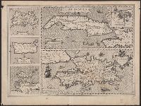
- Beinecke Rare Book and Manuscript Library > Cvba.
- Published / Created:
- [1825?]
- Call Number:
- 855 1825
- Container / Volume:
- BRBL_00641
- Image Count:
- 1
- Resource Type:
- Maps, Atlases & Globes
- Subject (Geographic):
- Cuba--Maps--Early works to 1800
- Found in:
- Beinecke Rare Book and Manuscript Library > Ile de Cuba dressée per Pierron d'apres la carte de M humbolt et cells du dépot de la marine.
- Published / Created:
- 1760?]
- Call Number:
- 855cea H29 1760
- Container / Volume:
- BRBL_00642
- Image Count:
- 1
- Resource Type:
- Maps, Atlases & Globes
- Subject (Geographic):
- Havana Bay (Cuba)--Maps--Early works to
- Found in:
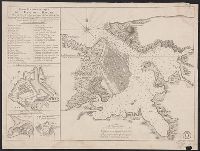
- Beinecke Rare Book and Manuscript Library > Cartr Hydrographiqye de la Baye de la Havane ... Par le Sr. Bellin ...
- Creator:
- Bellin, Jacques Nicolas, 1703-1772, creator
Choiseul, Etienne-François, duc de, 1719-1785
France, DeÌpoÌ?t des cartes et plans de la marine
- Published / Created:
- 1762?
- Call Number:
- 2003 Folio 85
- Image Count:
- 1
- Subject (Geographic):
- Havana (Cuba) -- Maps -- Early works to
- Subject (Topic):
- -- Early works to 1800
- Found in:
- Beinecke Rare Book and Manuscript Library > Carte hydrographique de la baye de la Havane: avec le plan de la ville et de ses forts pour joindre a la Carte de l'isle de Cube
- Creator:
- Mercator, Gerhard, 1512-1594
- Published / Created:
- 1606]
- Call Number:
- 855 1634
- Container / Volume:
- BRBL_00695
- Image Count:
- 2
- Resource Type:
- Maps, Atlases & Globes
- Subject (Geographic):
- Cuba--Maps--Early works to 1800
- Found in:
- Beinecke Rare Book and Manuscript Library > Cuba Insula ; Hispaniola Insula [cartographic material].
- Creator:
- Mercator, Gerhard, 1512-1594
- Published / Created:
- 1633]
- Call Number:
- 855 1628
- Container / Volume:
- BRBL_00641
- Image Count:
- 2
- Resource Type:
- Maps, Atlases & Globes
- Subject (Geographic):
- Cuba--Maps--Early works to 1800
- Found in:
- Beinecke Rare Book and Manuscript Library > Cuba Insula ; Hispaniola Insula [cartographic material].