Search
You Searched For
Search Results
- Published / Created:
- 1776
- Call Number:
- 775cea 1776
- Container / Volume:
- BRBL_00502
- Image Count:
- 1
- Resource Type:
- Maps, Atlases & Globes
- Subject (Geographic):
- Delaware Bay (Del and N.J.)--Maps
- Found in:
- Beinecke Rare Book and Manuscript Library > A chart of Delaware Bay and River ... by joshua Fisher.
- Published / Created:
- [1790?]
- Call Number:
- 775 1790
- Container / Volume:
- BRBL_00502
- Image Count:
- 1
- Resource Type:
- Maps, Atlases & Globes
- Subject (Geographic):
- Delaware Bay (Del. and N.J.)--Maps
- Found in:
- Beinecke Rare Book and Manuscript Library > A chart of Delaware Bay and River corected from the Best Surveys.
- Published / Created:
- 1776
- Call Number:
- 775cea 1776B
- Container / Volume:
- BRBL_00502
- Image Count:
- 1
- Resource Type:
- Maps, Atlases & Globes
- Subject (Geographic):
- Delaware Bay (Del. and N.J.)--Maps
- Found in:
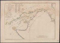
- Beinecke Rare Book and Manuscript Library > A chart of Delaware Bay and River. Contains a full and exact description of the shores, creeks, harbours, soundings, shoals, sands and bearings of the most considerable landmarks from the Capes to Philadelphia taken from the original chart.
- Published / Created:
- 1777
- Call Number:
- 775cea 1777
- Container / Volume:
- BRBL_00502
- Image Count:
- 2
- Resource Type:
- Maps, Atlases & Globes
- Subject (Geographic):
- Delaware Bay (Del. and N.J.)--Maps
- Found in:
- Beinecke Rare Book and Manuscript Library > BAye de la Delaware avec les ports, sondes, dangers, bancs, &c, depuis les caps jusqu'a Philadelphie, d'apres la carte de Joshua Fisher publiee a Philadelphie.
- Call Number:
- 1974 Folio 72
- Collection Title:
- The English pilot: describing the West-India navigation, from Hudson's-Bay to the river Amazones
- Image Count:
- 1
- Subject (Geographic):
- Delaware Bay (Del. and N.J.) --Maps
- Found in:
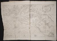
- Beinecke Rare Book and Manuscript Library > Virginia, Maryland, Pennsilvania, east & west New Jarsey