Search
You Searched For
Search Results
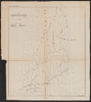
- Creator:
- Kane, Elisha Kent
- Published / Created:
- 1855]
- Call Number:
- 74 1855
- Container / Volume:
- BRBL_00394
- Image Count:
- 1
- Resource Type:
- Maps, Atlases & Globes
- Subject (Topic):
- Discoveries in geography--Maps
- Found in:
- Beinecke Rare Book and Manuscript Library > Chart exhibiting the discoveries of the Second-American-Grinnell-Expedition in search of Sir John Franklin : unrevised from the original material and projected on the spot / E. K. Kent.
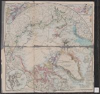
- Creator:
- Weller, Edward
- Published / Created:
- [1860]
- Call Number:
- 18 1870
- Image Count:
- 1
- Resource Type:
- Maps, Atlases & Globes
- Subject (Topic):
- Discoveries in geography--Maps
- Found in:
- Beinecke Rare Book and Manuscript Library > North circumpolar regions ; Vancouver Island ; Kamtschatka.
- Creator:
- Grosvenor, Gilbert Hovey, 1875-1966
- Published / Created:
- c1910
- Call Number:
- 18 1910
- Container / Volume:
- BRBL_00013
- Image Count:
- 1
- Resource Type:
- Maps, Atlases & Globes
- Subject (Topic):
- Discoveries in geography--Maps
- Found in:
- Beinecke Rare Book and Manuscript Library > The Arctic region showing explorations towards the North Pole / prepared by Gilbert H. Grosvenor, Director and Editor of the National Geographic Society.
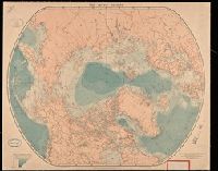
- Creator:
- Edward Stanford Ltd.
- Published / Created:
- [between 1890 and 1900]
- Call Number:
- BrSides Double Folio 2019 10
- Image Count:
- 1
- Resource Type:
- Maps, Atlases & Globes
- Subject (Topic):
- Discoveries in geography--Maps
- Found in:
- Beinecke Rare Book and Manuscript Library > The arctic regions.
- Creator:
- Faden, William, 1749-1836
Palmer, W. (William), 1739-1812
Roberts, Henry, Lieut, creator
- Published / Created:
- 1784
- Call Number:
- 1982 Folio 10
- Image Count:
- 1
- Subject (Topic):
- Discoveries in geography --Maps --Early
- Found in:
- Beinecke Rare Book and Manuscript Library > Chart of the N.W. coast of America and the N.E. coast of Asia, explored in the years 1778 and 1779
- Creator:
- Faden, William, 1749-1836
Palmer, W. (William), 1739-1812
Roberts, Henry, Lieut
- Published / Created:
- 1784
- Call Number:
- 23 1784
- Container / Volume:
- BRBL_00019
- Image Count:
- 1
- Resource Type:
- Maps, Atlases & Globes
- Subject (Topic):
- Discoveries in geography--Maps--Early
- Found in:
- Beinecke Rare Book and Manuscript Library > Chart of the N.W. coast of America and the N.E. coast of Asia, explored in the years 1778 and 1779 / prepared by Lieut. Heny. Roberts, under the immediate inspection of Capt. Cook ; engraved by W. Palmer.
- Creator:
- Delarochette, L. (Louis), 1731-1802, cartographer.
- Call Number:
- 23 1794A
- Image Count:
- 1
- Resource Type:
- Maps, Atlases & Globes
- Subject (Topic):
- Discoveries in geography--Maps--Early
- Found in:
- Beinecke Rare Book and Manuscript Library > Chart of the N.W. coast of America and the N.E. coast of Asia, explored in the years 1778 and 1779 / prepared by Lieut. Heny. Roberts, under the immediate inspection of Capt. Cook ; engraved by W. Palmer, No. 128, Chancery Lane.
- Creator:
- Faden, William, 1749-1836, creator
- Published / Created:
- 1787 January 1
- Call Number:
- 1982 Folio 10
- Image Count:
- 1
- Subject (Topic):
- Discoveries in geography --Maps --To
- Found in:
- Beinecke Rare Book and Manuscript Library > A new general chart of the world : exhibiting the whole of the discoveries made by the late Captain James Cook, F.R.S. with the tracks of the ships under his command : also those of Cap'n Phipps (now Lord Mulgrave) in his expedition to the North Pole
- Creator:
- Imperatorskai︠a︡ akademīi︠a︡ nauk (Russia), cartographer, publisher.
- Call Number:
- 23 1773
- Image Count:
- 1
- Resource Type:
- Maps, Atlases & Globes
- Subject (Topic):
- Discoveries in geography--Maps--Early
- Found in:
- Beinecke Rare Book and Manuscript Library > Nouvelle carte des decouvertes faites par les vaisseaux Russiens aux côtes inconnues de l'Amérique Septentrionale avec les pais adiacents / dressée sur des memoires authentiques de ceux qui ont assisté a ces decouvertes et sur d'autres connoissances.
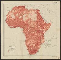
- Creator:
- Royal Geographical Society (Great Britain)
- Published / Created:
- 1911
- Call Number:
- 60bh 1911
- Container / Volume:
- BRBL_00329
- Image Count:
- 1
- Resource Type:
- Maps, Atlases & Globes
- Subject (Topic):
- Discoveries in geography--Africa--Maps
- Found in:
- Beinecke Rare Book and Manuscript Library > Africa showing progress of exploration / published by the Royal Geographical Society.