Search
You Searched For
Search Results
- Creator:
- Rizzi-Zannoni, Giovanni Antonio, 1736-1814, cartographer
- Published / Created:
- 1795
- Call Number:
- 402 1795
- Container / Volume:
- BRBL_00233
- Image Count:
- 4
- Resource Type:
- Maps, Atlases & Globes
- Subject (Geographic):
- Lombardy (Italy)--Maps--Early works to
- Found in:
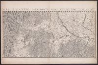
- Beinecke Rare Book and Manuscript Library > Nuova carta della Lombardia e delle sue regioni aggiacenti / formata d'ordine di S.M. Siciliana dal Reg. Geogr. G.A. Rizzi-Zannoni ; Gius. Guerra Nap. Reg. inc.
- Creator:
- Robert de Vaugondy, Gilles, 1688-1766, cartographer
- Published / Created:
- [approximately 1775?]
- Call Number:
- 402 1775A
- Container / Volume:
- BRBL_00233
- Image Count:
- 1
- Resource Type:
- Maps, Atlases & Globes
- Subject (Geographic):
- Lombardy (Italy)--Maps--Early works to
- Found in:
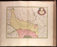
- Beinecke Rare Book and Manuscript Library > Partie occidentale de la Lombardie : et pays circonvoisins, où sont les États de Savoye, Piémont, Milan, Gênes, Plaisance &c. / par le Sr. Robert.
- Creator:
- Robert de Vaugondy, Gilles, 1688-1766, cartographer
- Published / Created:
- [approximately 1775?]
- Call Number:
- 402 1775
- Container / Volume:
- BRBL_00233
- Image Count:
- 1
- Resource Type:
- Maps, Atlases & Globes
- Subject (Geographic):
- Lombardy (Italy)--Maps--Early works to
- Found in:
- Beinecke Rare Book and Manuscript Library > Partie orientale de la Lombardie : qui comprend la République de Venise, le Mantouan, le Cremonese, l'Evêché de Trente, et les confins du Duché de Toscane, et de l'État de l'Église / par le Sr. Robert.
- Creator:
- Blaeu, Joan, 1596-1673, cartographer.
- Published / Created:
- 164-?]
- Call Number:
- 1973 Folio 18
- Image Count:
- 1
- Resource Type:
- Maps, Atlases & Globes
- Subject (Geographic):
- Lombardy (Italy)--Maps--Early works to
- Found in:
- Beinecke Rare Book and Manuscript Library > Territorio di Cremona [cartographic material].
- Creator:
- Baumeister, J. J.
- Published / Created:
- [approximately 1730]
- Call Number:
- BrSides Double Folio 2019 37
- Image Count:
- 1
- Resource Type:
- Maps, Atlases & Globes
- Subject (Geographic):
- Lombardy (Italy)--Maps--Early works to
- Found in:
- Beinecke Rare Book and Manuscript Library > Ducatus Mantuani quam castigatissima / delineatio per Dom. I.I. v. Baumeister ; legionis harrachianae subcenturionem curâ et sumptibus Matth. Seutteri, Sac. Caes. et Reg. Cath. Maj. Geogr.
- Creator:
- Keere, Pieter van den, 1571-approximately 1646
- Published / Created:
- [between 1652 and 1684]
- Call Number:
- BrSides Double Folio 2019 62
- Image Count:
- 1
- Resource Type:
- Maps, Atlases & Globes
- Subject (Geographic):
- Lombardy (Italy)--Maps--Early works to
- Subject (Topic):
- --Maps--Early works to 1800.
- Found in:
- Beinecke Rare Book and Manuscript Library > Italia Gallica, sive, Gallia Cisalpina / ex conatibus geographicis Abrah. Ortelij.
- Call Number:
- 402 M59 1660
- Container / Volume:
- BRBL_00233A
- Image Count:
- 2
- Resource Type:
- Maps, Atlases & Globes
- Subject (Geographic):
- Lombardy (Italy)--Maps--Early works to
- Found in:
- Beinecke Rare Book and Manuscript Library > Mediolanum Ducatus.
- Published / Created:
- [1800?]
- Call Number:
- 402 1800
- Container / Volume:
- BRBL_00705
- Image Count:
- 12
- Resource Type:
- Maps, Atlases & Globes
- Subject (Geographic):
- --Early works to 1800
- Found in:
- Beinecke Rare Book and Manuscript Library > [Manuscript map of Lombardy]. Fratelli Bordiga inc.
- Creator:
- Berry, W
Morden, R.
- Published / Created:
- 1688
- Call Number:
- 1976 1233
- Collection Title:
- Twenty four new and accurate maps of the several parts of Europe ... : all (except the last) new
- Image Count:
- 1
- Subject (Geographic):
- Lombardy (Italy) --Maps --Early works
- Found in:
- Beinecke Rare Book and Manuscript Library > A map of the sea coast of England France and Holland ...