Search
You Searched For
Search Results
- Creator:
- Bellin, Jacques Nicolas, 1703-1772
- Published / Created:
- 1764
- Call Number:
- 85 1764
- Container / Volume:
- BRBL_00693
- Image Count:
- 1
- Resource Type:
- Maps, Atlases & Globes
- Subject (Topic):
- Coasts--Louisiana--Maps--Early works to
- Found in:
- Beinecke Rare Book and Manuscript Library > Carte reduite des costes de la Louisiane et de la Floride / [cartographic material] / dressée au Dépost des cartes, plans et journaux de la Marine pour le service des vaisseaux du roy par ordre de M. Le Duc de Choisel, colonel général des Suisses et G
- Creator:
- Bellin, Jacques Nicolas, 1703-1772, cartographer
- Published / Created:
- 1744
- Call Number:
- 85 1744
- Collection Title:
- Histoire et description generale de la Nouvelle France
- Container / Volume:
- BRBL_00731
- Image Count:
- 1
- Resource Type:
- Maps, Atlases & Globes
- Subject (Geographic):
- Louisiana--Maps--Early works to 1800
- Subject (Topic):
- Coasts--Louisiana--Maps--Early works to
- Found in:
- Beinecke Rare Book and Manuscript Library > Partie de la coste de la Louisiane et de la Floride [cartographic material] : depuis le Mississipi jusqua S[t]. Marc d'Apalache / dressée sur les manuscrits du depost des plans de la Marine par N.B. Ing[r] du Roy et de la Marine.
- Creator:
- Anville, Jean Baptiste Bourguignon d', 1697-1782
- Published / Created:
- [1752]
- Call Number:
- 2003 Folio 85
- Image Count:
- 1
- Subject (Geographic):
- Louisiana -- Maps -- Early works to
- Found in:
- Beinecke Rare Book and Manuscript Library > Carte de la Louisiane
- Creator:
- Jefferys, Thomas, d. 1771
- Published / Created:
- 1794
- Call Number:
- 795cea 1794
- Container / Volume:
- BRBL_00523
- Image Count:
- 1
- Resource Type:
- Maps, Atlases & Globes
- Subject (Topic):
- Coasts--Louisiana--Maps--Early works to
- Found in:
- Beinecke Rare Book and Manuscript Library > The western coast of Louisiana and the coast of New Leon / by Thos. Jefferys, geographer to His Majesty.
- Creator:
- Bowen, Emanuel, d. 1767
- Published / Created:
- 1752?]
- Call Number:
- 71 1752B
- Container / Volume:
- BRBL_00725
- Image Count:
- 1
- Resource Type:
- Maps, Atlases & Globes
- Subject (Geographic):
- Louisiana--Maps--Early works to 1800
- Found in:
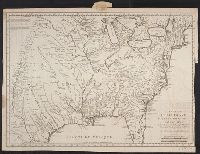
- Beinecke Rare Book and Manuscript Library > A new & accurate map of Louisiana, with part of Florida and Canada, and the adjacent countries / drawn from surveys, assisted by the most approved English & French maps & charts, the whole being regulated by astronl. observations. By Eman. Bowen.
- Creator:
- Bowen, Emanuel, d. 1767
- Published / Created:
- 1752?]
- Call Number:
- 71 1752
- Container / Volume:
- BRBL_00362
- Image Count:
- 1
- Resource Type:
- Maps, Atlases & Globes
- Subject (Geographic):
- Louisiana--Maps--Early works to 1800
- Found in:
- Beinecke Rare Book and Manuscript Library > A new & accurate map of Louisiana, with part of Florida and Canada, and the adjacent countries / drawn from surveys, assisted by the most approved English & French maps & charts, the whole being regulated by astronl. observations. By Eman. Bowen.
- Creator:
- Homann, Johann Baptist, 1663-1724
- Published / Created:
- between 1730 and 1763?]
- Call Number:
- 71 1730
- Container / Volume:
- BRBL_00362
- Image Count:
- 1
- Resource Type:
- Maps, Atlases & Globes
- Subject (Geographic):
- Louisiana--Maps--Early works to 1800
- Found in:
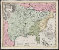
- Beinecke Rare Book and Manuscript Library > Amplissimae regionis Mississipi seu Provinciae Ludovicianae : â R.P. Ludovico Hennepin Francisc. Miss. in America Septentrionali anno 1687 detectae. nunc Gallorum Coloniis et actionum negotiis toto orbe celeberrimae, nova tabula / edita à Io. Bapt. Homa
- Creator:
- Bellin, Jacques Nicolas, 1703-1772
- Published / Created:
- 1744]
- Call Number:
- 755 1744
- Container / Volume:
- BRBL_00426
- Image Count:
- 1
- Resource Type:
- Maps, Atlases & Globes
- Subject (Geographic):
- Louisiana--Maps--Early works to 1800
- Found in:
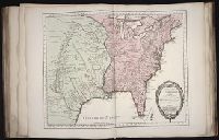
- Beinecke Rare Book and Manuscript Library > Carte de la Louisiane cours du Mississipi [i.e. Mississippi] et pais voisins : dediée à M. le Comte de Maurepas, ministre et secretaire d'etat commandeur des ordres du roy / par N. Bellin ingenieur de la marine, 1744 ; Dheulland sculp.
- Creator:
- Bellin, Jacques Nicolas, 1703-1772, creator
France, Depot des cartes et plans de la marine
- Published / Created:
- 1755?
- Call Number:
- 2003 Folio 85
- Image Count:
- 1
- Subject (Geographic):
- Louisiana -- Maps -- Early works to
- Found in:
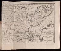
- Beinecke Rare Book and Manuscript Library > Carte de la Louisiane et des pays voisins: dediee a M. Rouille, secretaire d'Etat, ayant le Departement de la marine
- Call Number:
- Zc20 758Le
- Collection Title:
- Histoire de la Louisiane : contenant la decouverte de ce vaste pays ; sa description geographique
- Image Count:
- 1
- Subject (Geographic):
- Louisiana --Maps --Early works to 1800
- Found in:
- Beinecke Rare Book and Manuscript Library > Carte de la Louisiane colonie francaise avec le cours du fleuve St. Louis, les rivieres adjacentes, les nations de naturels, las etablissems francais, et les mines. Par l'Auteur de l'Histoire de cette Province 1757