Skip to search
Skip to main content
Skip to first result
Search
You Searched For
"Middle Atlantic States--Maps--Early works to 1800"
New Search
Search Results
Published / Created:
[between 1743 and 1770]
Call Number:
755 1730A
Container / Volume:
BRBL_00690
Image Count:
1
Resource Type:
Maps, Atlases & Globes
Subject (Geographic):
Middle Atlantic States --Maps --Early
Subject (Topic):
Coasts--Middle Atlantic States --Maps
Found in:
Beinecke Rare Book and Manuscript Library > Virginia, Maryland, Pennsilvania, east & west New Jarsey [cartographic material].
Creator:
Published / Created:
1787
Call Number:
1977 Folio 177
Image Count:
2
Resource Type:
Maps, Atlases & Globes
Subject (Geographic):
Middle Atlantic States --Maps --Early
Found in:
Beinecke Rare Book and Manuscript Library > A map of the country between Albemarle Sound, and Lake Erie [cartographic material] : comprehending the whole of Virginia, Maryland, Delaware and Pensylvania, with parts of several other of the United States of America / engraved by S.J. Neele.
Published / Created:
1776]
Call Number:
755 1776R
Container / Volume:
BRBL_00728
Image Count:
1
Resource Type:
Maps, Atlases & Globes
Subject (Geographic):
Middle Atlantic States --Maps --Early
Found in:
Beinecke Rare Book and Manuscript Library > A map of the country round Philadelphia : including part of New Jersey, New York, Staten Island & Long Island.
Published / Created:
[between 1693 and 1710?]
Call Number:
783 1711
Container / Volume:
BRBL_00691
Image Count:
1
Resource Type:
Maps, Atlases & Globes
Subject (Geographic):
Middle Atlantic States --Maps --Early
Found in:
Beinecke Rare Book and Manuscript Library > Carte particuliere de Virginie, Maryland, Pennsilvanie, la Nouvelle Iarsey orient et occidentale.
Published / Created:
1853
Call Number:
783.9643821
Container / Volume:
BRBL_00508
Image Count:
1
Resource Type:
Maps, Atlases & Globes
Subject (Geographic):
Middle Atlantic States --Maps --Early
Found in:
Beinecke Rare Book and Manuscript Library > A map of the country between Albemarle Sound, and Lake Erie, comprehending the whole of Virginia, Maryland, Delaware and Pensylvania, with parts of several other of the United States of America / engraved for Jefferson's notes on Virginia, London, 1787.
Published / Created:
[1749?]
Call Number:
755 1749
Container / Volume:
BRBL_00426
Image Count:
1
Resource Type:
Maps, Atlases & Globes
Subject (Topic):
Coasts--Middle Atlantic States --Maps
Found in:
Beinecke Rare Book and Manuscript Library > Virginia, Maryland, Pennsilvania, east & west New Jarsey [cartographic material].
Creator:
Published / Created:
[1676?]
Call Number:
755 1675E
Container / Volume:
BRBL_00423
Image Count:
1
Resource Type:
Maps, Atlases & Globes
Subject (Geographic):
Middle Atlantic States --Maps --Early
Found in:
Beinecke Rare Book and Manuscript Library > A map of New England, New Yorke, New Jersey, Mary-land & Virginia / Gr. King sculpsit.
Published / Created:
1777
Call Number:
755 1777S
Container / Volume:
BRBL_00728
Image Count:
1
Resource Type:
Maps, Atlases & Globes
Subject (Geographic):
Middle Atlantic States --Maps --Early
Found in:
Beinecke Rare Book and Manuscript Library > A map of the provinces of New-York and New-Jersey ... from the topographical observations of C.J. Sauthier / engraved ... by Matthew Albert Lotter.
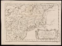
Creator:
Published / Created:
1764].
Call Number:
755 1764
Container / Volume:
BRBL_00429
Image Count:
1
Resource Type:
Maps, Atlases & Globes
Subject (Geographic):
Middle Atlantic States --Maps --Early
Found in:
Beinecke Rare Book and Manuscript Library > Carte de la Nouvelle Angleterre : New York, Pensilvanie et Nouveau Jersay suivant les cartes angloises.
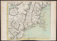
Creator:
Published / Created:
1757
Call Number:
BrSides 2018 139
Image Count:
1
Resource Type:
Maps, Atlases & Globes
Subject (Geographic):
Middle Atlantic States --Maps --Early
Found in:
Beinecke Rare Book and Manuscript Library > Carte de la Nouvelle Angleterre, Nouvelle Yorck, et Pensilvanie / pour servir à l'Histoire générale des voyages. Par M.B., ing. de la mare.
Branch:v1.60.98 ,Deployed:2024-04-17T09:54:29-04:00