Search
You Searched For
Search Results
- Creator:
- National Geographic Society (U.S.)
- Published / Created:
- 1949
- Call Number:
- 30 1949
- Container / Volume:
- BRBL_00032B
- Image Count:
- 1
- Resource Type:
- Maps, Atlases & Globes
- Subject (Topic):
- Middle East--Maps
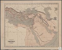
- Found in:
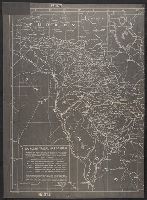
- Beinecke Rare Book and Manuscript Library > Europe and the Near East, Russian and Polish boundaries according to treaties and claims as of April 1, 1949.
- Published / Created:
- 1944]
- Call Number:
- 533ed 1932
- Container / Volume:
- BRBL_00288
- Image Count:
- 1
- Resource Type:
- Maps, Atlases & Globes
- Subject (Topic):
- Kurds--Middle East--Maps
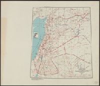
- Found in:
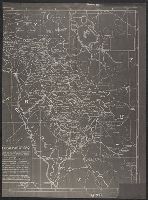
- Beinecke Rare Book and Manuscript Library > Kurdish tribal map of Iraq : showing the Iraq portion of Kurdistan and the major Kurdish tribal divisions within Iraq.
- Published / Created:
- 1944]
- Call Number:
- 533ed 1932
- Container / Volume:
- BRBL_00288
- Image Count:
- 1
- Resource Type:
- Maps, Atlases & Globes
- Subject (Topic):
- Kurds--Middle East--Maps
- Found in:
- Beinecke Rare Book and Manuscript Library > Kurdish tribal map of Iraq : showing the Iraq portion of Kurdistan and the major Kurdish tribal divisions within Iraq.
- Creator:
- Peltier, Georges
- Published / Created:
- 1916
- Call Number:
- 53 1916A
- Container / Volume:
- BRBL_00285
- Image Count:
- 1
- Resource Type:
- Maps, Atlases & Globes
- Subject (Geographic):
- Middle East--Maps
- Subject (Topic):
- World War, 1914-1918--Middle East--Maps
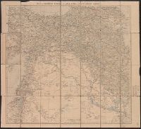
- Found in:
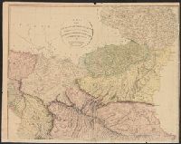
- Beinecke Rare Book and Manuscript Library > Les fronts d'Asie : de Salonique au Golfe Persique du Caucase a l'Isthme de Suez / G. Peltier, delt.
- Published / Created:
- 1804
- Call Number:
- 53 1804
- Container / Volume:
- BRBL_00284
- Image Count:
- 4
- Resource Type:
- Maps, Atlases & Globes
- Subject (Geographic):
- Middle East--Maps
- Found in:
- Beinecke Rare Book and Manuscript Library > A map of the Environs of Constantinople ... A. Arrowsmith 1801 and 1804.
- Published / Created:
- 1843?]
- Call Number:
- 51 B.C. 17
- Container / Volume:
- BRBL_00280
- Image Count:
- 1
- Resource Type:
- Maps, Atlases & Globes
- Subject (Geographic):
- Middle East--Maps
- Found in:
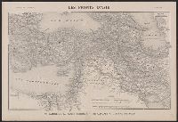
- Beinecke Rare Book and Manuscript Library > General map of the counties mentioned in the Bible.
- Creator:
- United States. Army Map Service
- Published / Created:
- 1943
- Call Number:
- 506gm 1943
- Container / Volume:
- BRBL_00276
- Image Count:
- 1
- Resource Type:
- Maps, Atlases & Globes
- Subject (Geographic):
- Middle East--Maps
- Found in:
- Beinecke Rare Book and Manuscript Library > Levant states, special strategic map / compiled by the Army Map Service, May 1943.
- Creator:
- Royal Geographical Society (Great Britain)
- Published / Created:
- 1921
- Call Number:
- 53 1921
- Container / Volume:
- BRBL_00285
- Image Count:
- 1
- Resource Type:
- Maps, Atlases & Globes
- Subject (Geographic):
- Middle East--Maps
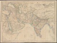
- Found in:
- Beinecke Rare Book and Manuscript Library > Map of eastern Turkey in Asia, Syria and western Persia [cartographic material].
- Creator:
- Royal Geographical Society (Great Britain)
- Published / Created:
- [1915?]
- Call Number:
- 53 1915
- Container / Volume:
- BRBL_00285
- Image Count:
- 1
- Resource Type:
- Maps, Atlases & Globes
- Subject (Geographic):
- Middle East--Maps
- Found in:
- Beinecke Rare Book and Manuscript Library > Map of eastern Turkey in Asia, Syria and western Persia [cartographic material].
- Published / Created:
- 1839
- Call Number:
- 53 1839
- Container / Volume:
- BRBL_00284
- Image Count:
- 2
- Resource Type:
- Maps, Atlases & Globes
- Subject (Geographic):
- Middle East--Maps
- Found in:
- Beinecke Rare Book and Manuscript Library > Map of the Countries lying betwen Turkey and Birmah, Comprising Asia Minor, Persia, India, Egypt, and Arabia and including the Black, Caspian, and Red Seas. By James Wyld, Geographer to t he Queen.