Search
You Searched For
Search Results
- Creator:
- Buache, Philippe, 1700-1773
- Published / Created:
- [1740]
- Call Number:
- 85 1740B
- Container / Volume:
- BRBL_00693
- Image Count:
- 1
- Resource Type:
- Maps, Atlases & Globes
- Subject (Topic):
- Nautical charts--Caribbean Area--Early
- Found in:
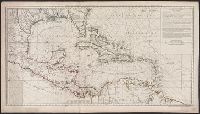
- Beinecke Rare Book and Manuscript Library > Carte d'une partie de l'Amérique [cartographic material] : pour la navigation des isles et du Golfe du Mexique avec l'interieur des terres depuis la Bermude jusqu'a Cayenne, partie meridionale, reduite de la carte angloise en 20 feuilles / par Mr. Popple
- Creator:
- Cruz Cano y Olmedilla, Juan de la, d. 1790
Lopez de Vargas Machuca, Tomas, 1731-1802, creator
- Published / Created:
- 1755
- Call Number:
- 2003 Folio 85
- Image Count:
- 1
- Subject (Topic):
- Nautical charts -- Caribbean Area
- Found in:
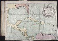
- Beinecke Rare Book and Manuscript Library > Mapa maritimo del Golfo de Mexico e islas de la America: para el uso de los navegantes en esta parte del mundo, construido sobre las mexores memorias, y observaciones astronomicas de longitudes, y latitudes
- Creator:
- Gibson, J. (John)
- Call Number:
- 1973 Folio 67
- Collection Title:
- The West-India pilot: containing piloting directions for Port Royal and Kingston harbours in
- Image Count:
- 1
- Subject (Topic):
- Nautical charts --Caribbean Area
- Found in:
- Beinecke Rare Book and Manuscript Library > Aiguiade de Port o Rico
- Call Number:
- 1973 Folio 67
- Collection Title:
- The West-India pilot: containing piloting directions for Port Royal and Kingston harbours in
- Image Count:
- 1
- Subject (Topic):
- Nautical charts --Caribbean Area
- Found in:
- Beinecke Rare Book and Manuscript Library > Chart of the Bay of Honduras
- Call Number:
- 1973 Folio 67
- Collection Title:
- The West-India pilot: containing piloting directions for Port Royal and Kingston harbours in
- Image Count:
- 1
- Subject (Topic):
- Nautical charts --Caribbean Area
- Found in:
- Beinecke Rare Book and Manuscript Library > Island of Old Providence
- Call Number:
- 1973 Folio 67
- Collection Title:
- The West-India pilot: containing piloting directions for Port Royal and Kingston harbours in
- Image Count:
- 1
- Subject (Topic):
- Nautical charts --Caribbean Area
- Found in:
- Beinecke Rare Book and Manuscript Library > Plan de la Rade du Port Paix
- Call Number:
- 1973 Folio 67
- Collection Title:
- The West-India pilot: containing piloting directions for Port Royal and Kingston harbours in
- Image Count:
- 1
- Subject (Topic):
- Nautical charts --Caribbean Area
- Found in:
- Beinecke Rare Book and Manuscript Library > Plan du Cap Francois
- Call Number:
- 1973 Folio 67
- Collection Title:
- The West-India pilot: containing piloting directions for Port Royal and Kingston harbours in
- Image Count:
- 1
- Subject (Topic):
- Nautical charts --Caribbean Area
- Found in:
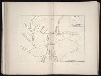
- Beinecke Rare Book and Manuscript Library > Plan du cul de sac de Leogane ou le Port au Prince
- Call Number:
- 1973 Folio 67
- Collection Title:
- The West-India pilot: containing piloting directions for Port Royal and Kingston harbours in
- Image Count:
- 1
- Subject (Topic):
- Nautical charts --Caribbean Area
- Found in:
- Beinecke Rare Book and Manuscript Library > Plan du port de Gouadaquini now called Jekil Sound in the province of Georgia in North America
- Creator:
- Bowen, Thomas, d. 1790
- Published / Created:
- 1773
- Call Number:
- 1973 Folio 67
- Collection Title:
- The West-India pilot: containing piloting directions for Port Royal and Kingston harbours in
- Image Count:
- 1
- Subject (Topic):
- Nautical charts --Caribbean Area
- Found in:
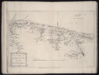
- Beinecke Rare Book and Manuscript Library > Plan of Black River on the Mosquito Shore