Search
You Searched For
Search Results
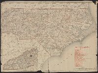
- Creator:
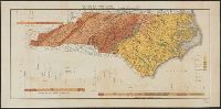
- Holmes, J. A. (Joseph Austin), 1859-1915
- Published / Created:
- 1887
- Call Number:
- 785ca 1887
- Container / Volume:
- BRBL_00514
- Image Count:
- 1
- Resource Type:
- Maps, Atlases & Globes
- Description:
- "The base is Kerr's Map of North
- Subject (Geographic):
- North Carolina--Maps
- Subject (Topic):
- Geology--North Carolina--Maps
- Found in:
- Beinecke Rare Book and Manuscript Library > Geological map of North Carolina : revised from the records of the survey / by J.A. Holmes, 1887.
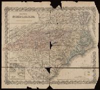
- Creator:
- G.W. & C.B. Colton & Co.
- Published / Created:
- 1855
- Call Number:
- BrSides Folio 2019 9
- Image Count:
- 1
- Resource Type:
- Maps, Atlases & Globes
- Subject (Geographic):
- North Carolina--Maps
- Subject (Topic):
- Coal mines and mining--North Carolina
- Found in:
- Beinecke Rare Book and Manuscript Library > Colton's North Carolina [cartographic material].
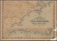
- Creator:
- Johnson and Ward
- Published / Created:
- [1866], c1865.
- Call Number:
- 785 1866
- Container / Volume:
- BRBL_00513
- Image Count:
- 2
- Resource Type:
- Maps, Atlases & Globes
- Subject (Geographic):
- North Carolina--Maps
- Subject (Topic):
- Railroads--North Carolina--Maps
- Found in:
- Beinecke Rare Book and Manuscript Library > Johnson's North and South Carolina / by Johnson and Ward.
- Creator:
- Charles Waring & Co
- Published / Created:
- 1876
- Call Number:
- 801gbc K77 1876
- Container / Volume:
- BRBL_00541
- Image Count:
- 1
- Resource Type:
- Maps, Atlases & Globes
- Subject (Geographic):
- North Carolina--Maps
- Subject (Topic):
- Minerals--North Carolina--Maps
- Found in:
- Beinecke Rare Book and Manuscript Library > Map of east Tennessee & western North Carolina : showing mineral deposits in vicinity of Knoxville, Tenn. / drawn by Charles Waring & Co.
- Creator:
- G.W. & C.B. Colton & Co
- Published / Created:
- [1884?], c1883.
- Call Number:
- 7855 1883
- Container / Volume:
- BRBL_00515
- Image Count:
- 1
- Resource Type:
- Maps, Atlases & Globes
- Subject (Geographic):
- North Carolina--Maps
- Subject (Topic):
- Railroads--North Carolina--Maps
- Found in:
- Beinecke Rare Book and Manuscript Library > Colton's North Carolina and South Carolina.
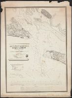
- Published / Created:
- 1839
- Call Number:
- 785cea B382 1839
- Container / Volume:
- BRBL_00514
- Image Count:
- 1
- Resource Type:
- Maps, Atlases & Globes
- Subject (Geographic):
- North Carolina--Maps
- Found in:
- Beinecke Rare Book and Manuscript Library > Baufort Harbour North Carolina ... By Liutenant James Glynn ...
- Creator:
- Colton, J. H. (Joseph Hutchins), 1800-1893
- Published / Created:
- 1861
- Call Number:
- 785 1861
- Container / Volume:
- BRBL_00513
- Image Count:
- 2
- Resource Type:
- Maps, Atlases & Globes
- Subject (Geographic):
- North Carolina--Maps
- Found in:
- Beinecke Rare Book and Manuscript Library > Colton's new topographical map of the eastern portion of the state of North Carolina : with part of Virginia & South Carolina.
- Creator:
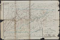
- Wilkes, Charles, 1798-1877
- Published / Created:
- 1858
- Call Number:
- 785 D36 1858
- Container / Volume:
- BRBL_00513
- Image Count:
- 1
- Resource Type:
- Maps, Atlases & Globes
- Subject (Geographic):
- North Carolina--Maps
- Found in:
- Beinecke Rare Book and Manuscript Library > Map of the Deep River District, North Carolina / by Capt. C. Wilkes, U.S.N.
- Creator:
- Rand McNally and Company
- Published / Created:
- c1895.
- Call Number:
- 785 1895
- Container / Volume:
- BRBL_00513
- Image Count:
- 2
- Resource Type:
- Maps, Atlases & Globes
- Alternative Title:
- of North Carolina
- Subject (Geographic):
- North Carolina--Maps
- Found in:
- Beinecke Rare Book and Manuscript Library > North Carolina.
- Published / Created:
- 1864
- Call Number:
- 785hc 1864
- Container / Volume:
- BRBL_00514
- Image Count:
- 1
- Resource Type:
- Maps, Atlases & Globes
- Subject (Geographic):
- North Carolina--Maps
- Found in:
- Beinecke Rare Book and Manuscript Library > [Military map of North Carolina : between Raleigh and Greensboro ca. 1864].