Search
You Searched For
Search Results
- Published / Created:
- 1703
- Call Number:
- 356 1703
- Container / Volume:
- BRBL_00113
- Image Count:
- 1
- Resource Type:
- Maps, Atlases & Globes
- Subject (Geographic):
- Poland--Maps--Early works to 1800
- Found in:
- Beinecke Rare Book and Manuscript Library > La Pologne ... Par Guillaume Del'Isle ...
- Published / Created:
- 1770
- Call Number:
- 356 1770
- Container / Volume:
- BRBL_00113
- Image Count:
- 1
- Resource Type:
- Maps, Atlases & Globes
- Subject (Geographic):
- Poland--Maps--Early works to 1800
- Found in:
- Beinecke Rare Book and Manuscript Library > La Pologne Comprenant le Royaume de Prusse, les Duchés de Lithuanie, et de Curlande Avec ses Limitrophes: le Royaume de Bohême, le cercle de la haute Saxe, Partie de la Russie ... le Sr. Moithey Ing?
- Published / Created:
- [1752?]
- Call Number:
- 356 1752
- Container / Volume:
- BRBL_00113
- Image Count:
- 1
- Resource Type:
- Maps, Atlases & Globes
- Subject (Geographic):
- Poland--Maps--Early works to 1800
- Found in:
- Beinecke Rare Book and Manuscript Library > Le Royaume de Pologne ... Par le Sr. Robert de Vaugondy.
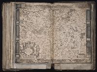
- Creator:
- Hondius, Jodocus, 1594 or 5-1629
Jansson, Jan, 1588-1664. Atlantis maioris appendix
- Published / Created:
- [ca. 1630]
- Call Number:
- 1983 Folio 19
- Collection Title:
- [Atlas factice of 96 maps by Blaeu, Visscher, Jansson, Hondius and others]
- Image Count:
- 1
- Subject (Geographic):
- Poland --Maps --Early works to 1800
- Found in:
- Beinecke Rare Book and Manuscript Library > Nova Poloniae delineatio
- Creator:
- Berry, William, fl. 1669-1708, creator
Burnford, Tho., engraver
Sanson, Nicolas, 1600-1667
- Published / Created:
- [ca. 1683]
- Call Number:
- 1973 Folio 10
- Image Count:
- 1
- Resource Type:
- Maps, Atlases & Globes
- Subject (Geographic):
- Poland --Maps --Early works to 1800
- Found in:
- Beinecke Rare Book and Manuscript Library > Poland : subdivided according to the extent of its severall palatinates
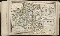
- Published / Created:
- Undated
- Call Number:
- 1976 1233
- Collection Title:
- Twenty four new and accurate maps of the several parts of Europe ... : all (except the last) new
- Image Count:
- 1
- Subject (Geographic):
- Poland --Maps --Early works to 1800
- Found in:
- Beinecke Rare Book and Manuscript Library > Poland according to ye newest observations
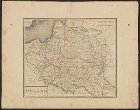
- Published / Created:
- 1795]
- Call Number:
- 356 1795
- Container / Volume:
- BRBL_00114
- Image Count:
- 1
- Resource Type:
- Maps, Atlases & Globes
- Subject (Geographic):
- Poland--Maps--Early works to 1800
- Found in:
- Beinecke Rare Book and Manuscript Library > Poland, shewing the Claims of Russia, Prussia, and Austria, until the late Depredations, the extent of which cannot as yet be ascertained. W. Barker, Sculp.
- Published / Created:
- [1795?]
- Call Number:
- 356 1795A
- Container / Volume:
- BRBL_00114
- Image Count:
- 1
- Resource Type:
- Maps, Atlases & Globes
- Subject (Geographic):
- Poland--Maps--Early works to 1800
- Found in:
- Beinecke Rare Book and Manuscript Library > Poland.
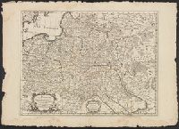
- Published / Created:
- [1680?]
- Call Number:
- 356 1680
- Container / Volume:
- BRBL_00113
- Image Count:
- 2
- Resource Type:
- Maps, Atlases & Globes
- Subject (Geographic):
- Poland--Maps--Early works to 1800
- Found in:
- Beinecke Rare Book and Manuscript Library > Polonia.
- Published / Created:
- [1595?]
- Call Number:
- 356 1595
- Container / Volume:
- BRBL_00113
- Image Count:
- 1
- Resource Type:
- Maps, Atlases & Globes
- Subject (Geographic):
- Poland--Maps--Early works to 1800
- Found in:
- Beinecke Rare Book and Manuscript Library > Poloniae, Lithuaniaeq descriptio Auctore Wenceslar Godreccio; et correctore Andrea Pograbio Pilsnensi.