Search
You Searched For
Search Results
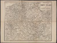
- Creator:
- Taride, A
- Published / Created:
- 191-
- Call Number:
- 383 1917
- Container / Volume:
- BRBL_00177
- Image Count:
- 1
- Resource Type:
- Maps, Atlases & Globes
- Subject (Topic):
- World War, 1914-1918--France--Maps
- Found in:
- Beinecke Rare Book and Manuscript Library > Carte du front Français [cartographic material] / A. Taride, editeur.
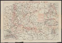
- Creator:
- Daily Mail (London)
- Published / Created:
- 1919
- Call Number:
- 11hc 1919
- Image Count:
- 2
- Resource Type:
- Maps, Atlases & Globes
- Subject (Topic):
- World War, 1914-1918--France--Maps
- Found in:
- Beinecke Rare Book and Manuscript Library > Daily Mail map of the battlefields of France.
- Creator:
- Great Britain. War Office
- Published / Created:
- 1917
- Call Number:
- 11hc 1914J
- Container / Volume:
- BRBL_00010A
- Image Count:
- 1
- Resource Type:
- Maps, Atlases & Globes
- Subject (Topic):
- World War, 1914-1918--France--Maps
- Found in:
- Beinecke Rare Book and Manuscript Library > Map showing Allied progress on the front between Arras and the Aisne [cartographic material].
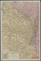
- Creator:
- Rand McNally and Company
- Published / Created:
- [1918]
- Call Number:
- 11hc 1917C
- Container / Volume:
- BRBL_00010D
- Image Count:
- 2
- Resource Type:
- Maps, Atlases & Globes
- Subject (Topic):
- World War, 1914-1918--France--Maps
- Found in:
- Beinecke Rare Book and Manuscript Library > Rand McNally war map of the French front : northern section : strategic map of the battle ground in northern France from St. Quentin to St. Mihiel, showing the farthest advance of the Germans in 1914 and the battle line in September, 1917.
- Creator:
- Rand McNally and Company
- Published / Created:
- [1918?]
- Call Number:
- 11hc 1917D
- Container / Volume:
- BRBL_00010D
- Image Count:
- 2
- Resource Type:
- Maps, Atlases & Globes
- Subject (Topic):
- World War, 1914-1918--France--Maps
- Found in:
- Beinecke Rare Book and Manuscript Library > Rand McNally war map of the French front : southern section : strategic map of the battle ground in northern France from St. Mihiel to the Swiss border / compiled from the latest military maps of the army staffs in Washington, London, and Paris, and from
- Creator:
- Geographia Ltd
Gross, Alexander, 1879-1958
- Published / Created:
- [1916?]
- Call Number:
- 11hcf 1919C-6
- Container / Volume:
- BRBL_00010V
- Image Count:
- 1
- Resource Type:
- Maps, Atlases & Globes
- Subject (Topic):
- World War, 1914-1918--France--Maps
- Found in:
- Beinecke Rare Book and Manuscript Library > The Daily telegraph war map no. 15 [cartographic material] : of the western front, Verdun to Belfort / By Alexander Gross ; Geographia Ltd.
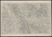
- Creator:
- France. Corps d'état-major
- Published / Created:
- 1917
- Call Number:
- 38315cbf V585 1913
- Container / Volume:
- BRBL_00177
- Image Count:
- 1
- Resource Type:
- Maps, Atlases & Globes
- Subject (Topic):
- World War, 1914-1918--France--Lorraine
- Found in:
- Beinecke Rare Book and Manuscript Library > Verdun.
- Published / Created:
- 1919.]
- Call Number:
- 11hcf 1919A-6
- Container / Volume:
- BRBL_00010N
- Image Count:
- 1
- Resource Type:
- Maps, Atlases & Globes
- Subject (Topic):
- World War, 1914-1918--France--Maps
- Found in:
- Beinecke Rare Book and Manuscript Library > [Sketch map used by the French in discussions of Rhineland and French security.]
- Published / Created:
- 1918?]
- Call Number:
- 38hc 1918C
- Container / Volume:
- BRBL_00172
- Image Count:
- 1
- Resource Type:
- Maps, Atlases & Globes
- Subject (Topic):
- World War, 1914-1918--France--Lorraine
- Found in:
- Beinecke Rare Book and Manuscript Library > Grabenkarte.