Search
You Searched For
Search Results
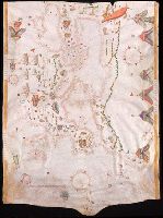
- Creator:
- Maggiolo, Giacomo.
- Published / Created:
- 1553
- Call Number:
- Manuscript 49cea 1553
- Image Count:
- 2
- Resource Type:
- Maps, Atlases & Globes
- Subject (Geographic):
- Mediterranean Region--Maps--Early works
- Found in:
- Beinecke Rare Book and Manuscript Library > [Portolano of the Mediterranean Sea and Europe].
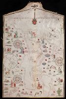
- Published / Created:
- 1590
- Call Number:
- 49cea 1590
- Image Count:
- 2
- Resource Type:
- Maps, Atlases & Globes
- Description:
- Crucifix at top of map.
- Subject (Geographic):
- Europe--Maps--Early works to 1800
- Found in:
- Beinecke Rare Book and Manuscript Library > [Portolan chart of the Mediterranean Sea and Europe].
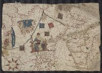
- Creator:
- Volčić, Vicko Dimitrije, 1563-1607, cartographer
- Published / Created:
- [1601]
- Call Number:
- Manuscript 49cea 1601
- Image Count:
- 2
- Resource Type:
- cartographic image
- Description:
- Coordinates not present on map and are
- Found in:
- Beinecke Rare Book and Manuscript Library > [Portolan chart of the Mediterranean Sea].
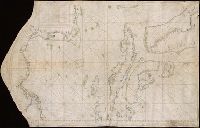
- Published / Created:
- [between 1800 and 1899?]
- Call Number:
- GEN MSS FILE 601 (Oversize)
- Image Count:
- 2
- Resource Type:
- cartographic image
- Description:
- manuscript portolan on vellum probably executed
- Found in:
- Beinecke Rare Book and Manuscript Library > Portolan chart of western Europe and the Mediterranean Sea
- Call Number:
- 32cea 1550
- Container / Volume:
- BRBL_00701
- Image Count:
- 2
- Resource Type:
- Maps, Atlases & Globes
- Subject (Geographic):
- Europe--Maps--Early works to 1800
- Found in:
- Beinecke Rare Book and Manuscript Library > [Section of a portolan chart spanning Great Britain in the west to the Adriatic Sea in the east.]
- Published / Created:
- [approximately 1600?]
- Call Number:
- Art Storage 986
- Image Count:
- 2
- Resource Type:
- Maps, Atlases & Globes
- Description:
- Coordinates not present on map and are
- Subject (Geographic):
- Mediterranean Sea--Maps--Early works to
- Found in:
- Beinecke Rare Book and Manuscript Library > Portolan chart of the Mediterranean Sea.
- Published / Created:
- [ca. 1760]
- Call Number:
- 85cea 1760
- Container / Volume:
- BRBL_00719
- Image Count:
- 2
- Resource Type:
- Maps, Atlases & Globes
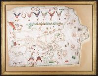
- Description:
- the map. On the Island of Jamaica is
- Subject (Geographic):
- Mexico, Gulf of--Maps--Early works to
- Found in:
- Beinecke Rare Book and Manuscript Library > [Manuscript map of the West Indies].
- Creator:
- Fernandes, José, Cartographer, cartographer.
- Call Number:
- Manuscript 911cea 1789
- Image Count:
- 2
- Resource Type:
- Maps, Atlases & Globes
- Description:
- Coordinates not present on map and are
- Subject (Geographic):
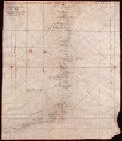
- Brazil--Maps--Early works to 1800.
- Subject (Topic):
- Coasts--Brazil--Maps--Early works to
- Found in:
- Beinecke Rare Book and Manuscript Library > Carta reduzida de hua parte de costa do Brasil : desde o Morro de S. Paulo athê Santos / por José Fernandes, Portugal na Bahia de Todos os Santos no Anno de 1789.
- Creator:
- Maggiolo, Vesconte, active 1504-1549.
- Call Number:
- Art Storage 1980 156
- Image Count:
- 2
- Resource Type:
- Maps, Atlases & Globes
- Description:
- Portolan chart with seaport names given
- Subject (Geographic):
- Baltic Sea--Maps--Early works to 1800.
- Subject (Topic):
- Manuscript maps --Mediterranean Region
- Found in:
- Beinecke Rare Book and Manuscript Library > [Portolan chart of the Mediterranean Sea, the North Atlantic Ocean, the Baltic Sea, and the West African coast].
- Creator:
- Oliva, Joan, fl. 1580-1615
- Call Number:
- Art Storage 30cea 1555
- Image Count:
- 2
- Resource Type:
- Maps, Atlases & Globes
- Description:
- and inset map of the world in the lower
- Subject (Geographic):
- Baltic Sea--Maps--Early works to 1800
- Found in:
- Beinecke Rare Book and Manuscript Library > [Portolan chart of the Mediterranean Sea, the North Atlantic Ocean, the Baltic Sea, and the northwestern African coast].